Tornado Rips Through Thumb
An outbreak of multicell clusters and supercells developed across Southeast Michigan last Friday. These storms produced areas of wind damage, large hail to golf ball size, heavy rain, and an EF0 tornado in Sanilac County before moving eastward into Canada and the lakes during the evening. Numerous trees were downed across the region, and there was there are approximately 10,000 acres of crops in Sanilac County that have damage from the storm, starting at Berkshire and Snover Roads, to Greening and Walker Road – sugar beets, corn, soybeans, dry beans and wheat.
Hail did most of the damage to the crops, up to 3/4”, with the wind only adding to it, especially in the corn, as it was torn, it just kept shredding down.

There is approximately a 3-5 day window to help some of these crops bounce back from the damage, according to Renzie Milarch, Nutrien Ag Solutions manager in Sandusky and Deckerville.
He said, “ Depending on the severity of damage, they can, by aerial treatment only, apply fungicide, plant growth hormones or foliar fertilizer.” The corn is in question, as it needs to tassle to produce a cob, and it may be too late or too damaged for that. Harvesting it at this point, according to a local farmer, “it would be very sappy and would juice and make a mess.”
The sugar beets should bounce back, but again, with soybeans and dry beans, it is question of regrowth, and if there is enough time for that growth.
Some farmers carry insurance, varying in coverage. Some will cover as much as 85% – which is based on a 10-year proven record of yield, to smaller amounts of coverage. But, for those that don’t carry insurance, it will be a total loss. As August is only a couple of weeks away, time to replant is minimal.
Several homes in the area were reported with damage to siding due to wind-blown hail.
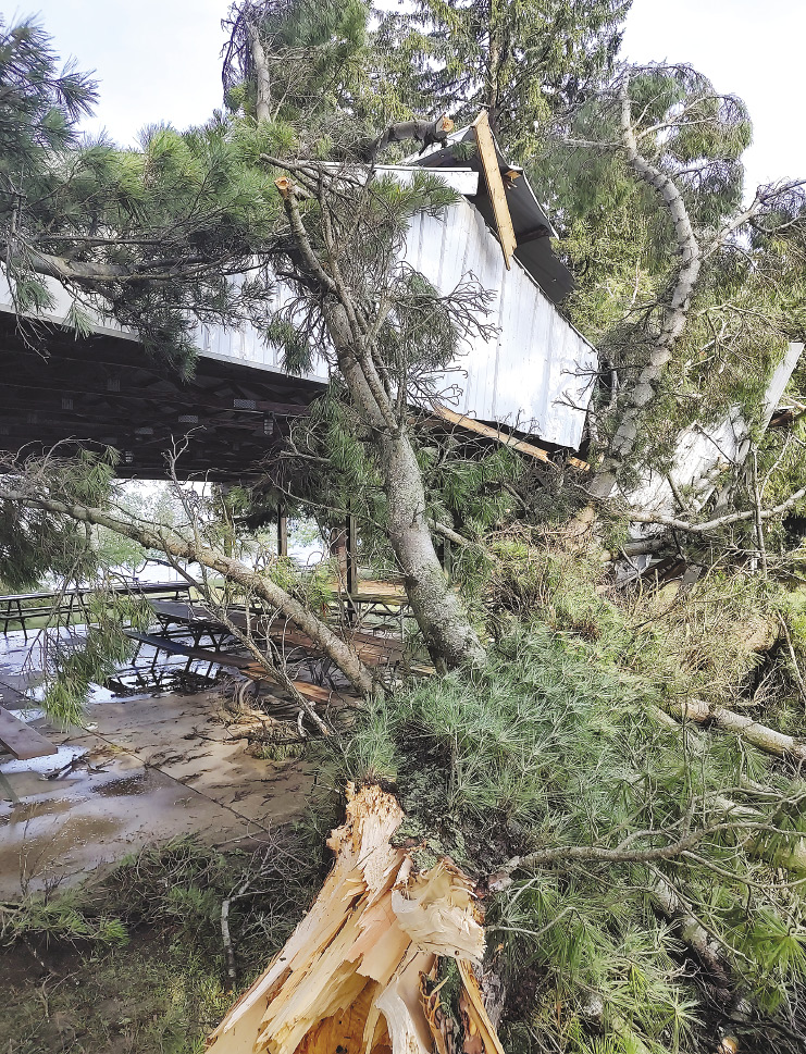
The tornado touched down southeast of Applegate and tracked southeast through Townsend Road and Wixson Road. The main damage in this area was large snapped tree limbs and crop damage. Estimated winds in this area were up to 70 mph. The beginning of the more concentrated area of damage was near the intersection of Babcock Road and Aitken Road. In this area, several large limbs were snapped and softwood trees uprooted in a circular pattern with one home having minor damage to its fascia. Estimated peak winds in this concentrated area of damage were up to 80 mph with a width of 475 yards. The track continued moving to southeast crossing M-25 into Sanilac County Lexington Park where additional large tree limbs were downed and one snapped small softwood tree. One of the larger tree limbs fell onto a camper in the park. The track of the tornado then exited into Lake Huron.